


Precinct 39, Webster Parish, Louisiana
About
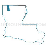
Outline

Summary
| Unique Area Identifier | 591323 |
| Name | Precinct 39 |
| County | Webster Parish |
| State | Louisiana |
| Area (square miles) | 44.17 |
| Land Area (square miles) | 41.50 |
| Water Area (square miles) | 2.67 |
| % of Land Area | 93.97 |
| % of Water Area | 6.03 |
| Latitude of the Internal Point | 32.46455170 |
| Longtitude of the Internal Point | -93.28515870 |
Maps


Graphs
Select a template below for downloading or customizing gragh for Precinct 39, Webster Parish, Louisiana


Neighbors
Neighoring Voting District (by Name) Neighboring Voting District on the Map
- Precinct 3-4, Bienville Parish, LA
- Precinct 32, Webster Parish, LA
- Precinct 34, Webster Parish, LA
- Precinct 35, Webster Parish, LA
- Precinct 36, Webster Parish, LA
- Precinct 38, Webster Parish, LA
- Precinct 4-2, Bienville Parish, LA
- Precinct 4-4, Bienville Parish, LA
- Precinct 40, Webster Parish, LA
- Precinct 41, Webster Parish, LA
Top 10 Neighboring County Subdivision (by Population) Neighboring County Subdivision on the Map
- District 11, Webster Parish, LA (4,149)
- District 12, Webster Parish, LA (4,031)
- District 7, Webster Parish, LA (3,394)
- District 4, Bienville Parish, LA (2,077)
- District 3, Bienville Parish, LA (1,820)
Top 10 Neighboring Place (by Population) Neighboring Place on the Map
Top 10 Neighboring Unified School District (by Population) Neighboring Unified School District on the Map
Top 10 Neighboring State Legislative District Lower Chamber (by Population) Neighboring State Legislative District Lower Chamber on the Map
Top 10 Neighboring State Legislative District Upper Chamber (by Population) Neighboring State Legislative District Upper Chamber on the Map
Top 10 Neighboring 111th Congressional District (by Population) Neighboring 111th Congressional District on the Map
Top 10 Neighboring Census Tract (by Population) Neighboring Census Tract on the Map
- Census Tract 321, Webster Parish, LA (7,135)
- Census Tract 315, Webster Parish, LA (5,893)
- Census Tract 9703, Bienville Parish, LA (3,318)
- Census Tract 9704, Bienville Parish, LA (2,627)
Top 10 Neighboring 5-Digit ZIP Code Tabulation Area (by Population) Neighboring 5-Digit ZIP Code Tabulation Area on the Map
- 71023, LA (3,632)
- 71068, LA (3,627)
- 71073, LA (2,319)
- 71039, LA (1,934)
- 71024, LA (1,420)
- 71045, LA (663)